Hybrid Navigation System successfully deployed in Europe’s deepest mine
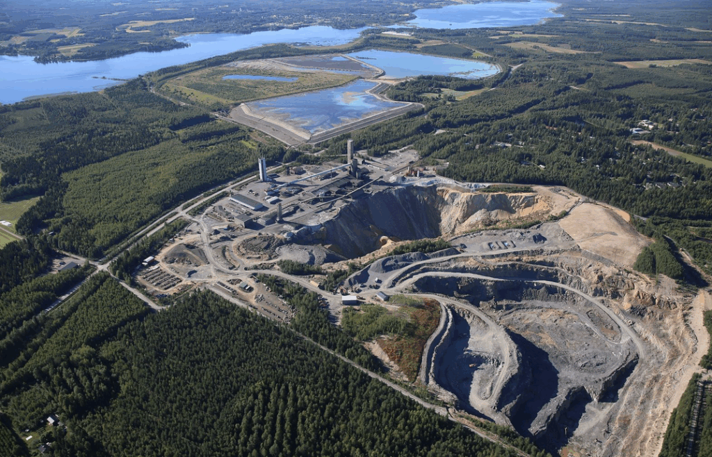
Aerial view of Pyhäsalmi, the deepest base metals mine in Europe. Image from Advanced Navigation.
Mining technology company Advanced Navigation announced, as part of BHP’s Deep Mining Challenge, its Hybrid Navigation System was successfully deployed in Europe’s deepest mine in Pyhäjärvi, Finland at 1.4km underground.
Pyhäsalmi is the deepest base metals mine in Europe, at a depth of 1,444 metres. The zinc and copper mine is located in the Northern Ostrobothnia province, owned by Canadian miner First Quantum Minerals.
The system entered a completely new environment – no GPS, no fixed infrastructure, no maps – and returned with precise positioning data, proving that the future of fully autonomous mining is within reach, the company said.
Challenges in underground navigation
Navigating the vast subterranean network of the Pyhäsalmi Mine poses significant challenges. Located 1.4 km underground with a 63 degree latitude – just two degrees below the Arctic Circle, where traditional systems fail – the mine is completely impervious to GNSS signals, Advanced Navigation said.
Its repetitive, multi-level tunnel network creates a high risk of visual disorientation, while its metallic ores distort magnetic fields and scatter radio waves.
To overcome these conditions, mines typically rely on infrastructure-heavy solutions such as ultra-wideband beacons, Wi-Fi, 5G repeaters, or perception-based techniques such as SLAM (Simultaneous Localization and Mapping) which require cameras.
These methods are costly to integrate and maintain, slow to install, and often unavailable in hazardous or unmapped zones where reliable navigation is most critical, the company said.
The Hybrid Navigation System, combining a Laser Velocity Sensor (LVS) with the Boreas D90 fiber-optic gyroscope (FOG) Inertial Navigation System (INS), achieved consistent sub-0.1% navigation error across multiple runs, without relying on any fixed positioning infrastructure, pre-existing maps, or external aiding.
“Unreliable navigation underground isn’t a minor technical constraint – it’s a major operational bottleneck,” Advanced Navigation product manager Joe Vandecar said in a news release.
“Maintaining precision over a 22.9km subterranean course in Europe’s deepest underground mine demonstrates a level of performance that few systems in the world can rival without any prior intelligence of the environment,” Vandecar said. “These results prove we’re one step closer to unlocking scalable underground autonomy.”
This post has been syndicated from a third-party source. View the original article here.